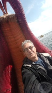
On a reed boat on lake Titicaca
The road to Titicaca
There is a lake, high in the Andes mountains; it is South America’s largest lake, and lies on the border between Peru and Bolivia. For hydrology nerds, water enters the lake from 27 rivers, and the catchment area is approximately 58,000 square kilometers, which is larger than the Netherlands, or Belgium, or Switzerland, and the lake is larger than Brunei, Luxembourg, and Singapore, combined. Titicaca is its name, and unfortunately, despite its location at nearly 4,000 meters altitude, is threatened by the activities of huns, both directly and indirectly: waste disposal and global warming respectively.
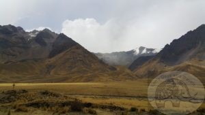
Desolate, cold, beautiful; on the road from Cusco to Puno.
The lake can be reached from different directions, but one of the most beautiful routes to the lake is the road from Cusco to Puno; the Route of the Sun. Although the trip takes nearly an entire day, the bus will stop at several places along the route for some sight seeing in smaller towns and markets, as well as one or two museums. One of the most beautiful places is a stretch of road, quite desolate, high in the mountains; bitingly cold, with snow on the surrounding mountains, but truly exhilarating; La Raya Pass, the highest pass in this region.
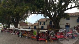
A small market in the town square
One of the first stops will be the Church of San Pedro of Andahuaylillas in a quaint little town by the same name, Andahuaylillas. A small market square fronts onto the church, and it is well worth spending a half hour viewing the church and the market square. The small church is from the early 1600s, and the interior beautifully decorated with wall murals and painted ceiling.
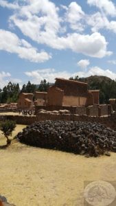
Ancient ruins of a huge temple with walls of nearly 3,000 feet in length
The next stop along the way is the archaeological site of Raqchi. The remnants of a huge temple, over 3,000 feet in length, are all that remain now of a temple dedicated to the supreme god of the Incas. At the same site, nearly 200 storehouses originally built of stone can be found, with some having been restored, while others can be identified only by the piles of rocks and their circular bases.
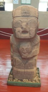
A pre-Incan sacred carved stone in Pucara
The third and final stop is the small town of Pucara, home to an archaeological site that dates back to more than 6,000 years ago. The museum, the Museo Litico de Pucara, although small, has some nice artifacts, including monoliths and ceramics.
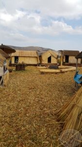
A reed island with thatched huts on lake Titicaca
Reed islands and a boat trip
Puno lies at an altitude of slightly more than 3,800 meters above sea level. A full half-kilometer higher than Cusco, a town where I had my first experience with altitude sickness. Luckily I had bought medication in Cusco the day after my first breathless and sleepless night due to altitude sickness, and I had high hopes of avoiding similar problems. Unfortunately, at 1a.m. those hopes were dashed, and I woke up short of breath, but without the panicky feeling of the previous experience. I reached over for the pills, washed one down with water, and settled down again. Within 20 minutes I was asleep again.

Reed boats for transport on the lake
The following morning I made the short walk to the bus station where I was to catch a bus to the pier and the start of the one-day excursion on lake Titicaca. There are various options for trips originating from Puno, including half-day, full-day and multiple-day trips, the latter with overnight stays on the man-made reed islands that dot the coastal area near Puno. Created from thick layers of cut Totora, a thick and buoyant reed, the small islands measure roughly 225 square meters, and are built and inhabited by the Uros (or Uru) people. The islands are constantly maintained by adding new layers of reeds. Thatched houses on the individual islands are usually inhabited by an extended family. Although visitors are delivered to these floating homes by motorboats, one of the highlights of a visit to one of the islands is a quick tour in a golden reed boat.
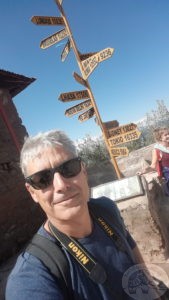
Direction marker on the island – it’s a long way to anywhere
Men knitting at 4,000 metres above sea level
From the reed islands it is almost an hour to Taquile Island, an island only 5.5 square kilometers in size, inhabited by roughly 2,200 people. The residents, known as Taquilenos, are known for their high quality woven textiles and it is only the men who do the knitting, and their skill was recognized in 2005 by UNESCO and proclaimed part of the Masterpieces of Oral and Intangible Heritage of Humanity. The main square of the small town is lined by a large 2-storey building that houses a crafts shop and exhibition hall. One side of the square looks out over lake Titicaca, and it truly is a beautiful sight to see. The walk from the pier to the town square should be taken slowly, as the altitude of the island is roughly 4,000 meters above sea level, and it is best to take the slow meandering walk along the shore going up than the other, much more steep climb on the opposite side of the island.
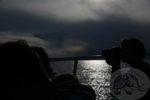
As evening approaches…returning to Puno
Back on board our boat, we started on the return journey to Puno. Already it was getting late in the afternoon, and as we sped across the lake and got closer to the city, we could see a vast plume of smoke rising from one of the reed islands; the island was purposely being burned to make way for new layers of reeds. The sun set, and the temperature was cooling quickly. We passed another small island before once again nearing the reed islands of the Uros. The day had been long, with plenty of adventure and walking. On the morrow I would set out on another trip, this one by bus across the border to the capital of Bolivia, La Paz. Silhouetted against the evening sky some passengers took in the view of Puno while others sat quietly watching the still waters of lake Titicaca.
